Utah Map

Request Free Visitor Guides

Mount Tukuhnikivatz

Basics
Location:
Near Moab
Length:
4.8 miles (round trip)
Difficulty:
Intermediate
Time:
4 1/2 hours
Elevation Change:
2362 feet
Season:
Midsummer through mid-fall.

Description

Anyone who has visited Canyonlands or Arches National Parks in the early summer has probably gazed admiringly at the snow capped peaks of the La Sal Mountains. The sight of snow seems oddly out of place in the midst of the desert heat, but snow is usually visible on the higher summits of the La Sals well into July. Tradition has it that the mountains were named by Silvestre Valez de Escalante, the Spanish missionary and explorer, who saw them during his expedition through Utah in 1776. He called them the Sierra La Sal, or "Salt Mountains” because he deemed it so unlikely that they could be covered with snow so late in the summer.

Details

Location:
Near Moab
Length:
4.8 miles (round trip)
Difficulty:
Intermediate
Time:
4 1/2 hours
Elevation Change:
2362
Season:
Midsummer through mid-fall.
Additional Details:
Before you begin the hike, pause to look northward from the parking area at the top of La Sal Pass. Mount Peale is the broad peak on your right, and Mount Tukuhnikivatz is the slightly lower but more pointed peak on the left. The two peaks are connected by a long summit ridge that runs in an east-west direction for about two miles. From the top of Mount Tukuhnikivatz the ridge drops down at a 30 degree angle into a small saddle about 500 feet below the summit of the mountain, and it is from that saddle that your final assent will be made. The best way to reach the summit ridge is to climb upward along the broad crest of the secondary north-south ridge that begins about a half mile from the trailhead and ends at the saddle near the peak.

You will start by walking northward through the open meadow in front of the parking area along an old jeep road. After a few hundred yards the jeep road bends to the left and then heads north again through a grove of spruce trees. The road stays in the trees for 0.2 mile and then emerges once more into another meadow. At this point you are at the foot of the secondary ridge which you must climb in order to reach the summit ridge. There is a vague trail leaving the jeep road and heading into the trees at the foot of the ridge, but the trail is difficult to find. Instead of wasting time looking for it just continue walking northward along the jeep road. The road follows the eastern side of the ridge for another 0.4 mile before it ends. When the road ends simply turn west and start climbing until you reach the crest of the ridge. The crest of the ridge is about 500 feet above the road at this point. It is a tiring climb, but at least there are no trees to hinder your progress.

When you reach the top of the secondary ridge you will find a trail that climbs along its crest to the summit ridge above. The route is very steep, but there are few obstacles. The trail finally reaches the Peale-Tukuhnikivatz summit ridge about 0.5 mile east of Mount Tukuhnikivatz, where once again you will be on relatively level ground. What a relief! The elevation is just over 12,000 feet, and the ground is covered with the grasses, mosses, and wild flowers of the Arctic-Alpine Tundra life zone. This area is part of the Mount Peale Research Natural Area, an area that was established in the 1980s to protect several species of endangered plants that occupy the above-treeline slopes of the La Sals. Try to tread gently across the tundra-especially if you are in a large group.

The route to the top of Mount Tukuhnikivatz from the summit ridge is quite obvious. Walking westward the grade soon increases, and the pleasant carpet of plant life is replaced by a tortuous field of broken stones. There is no trail-just a lung busting climb up the last few hundred feet to the top of the talus covered peak.

From the top a large swath of some of the most interesting terrain in Utah is clearly visible. To the north, in Arches National Park, the Courthouse Towers rise dramatically from the desert floor like tombstones in a cemetery for giants. The Behind the Rocks area west of Moab is also clearly discernible, and the Colorado River Gorge that separates the Needles District from the rest of Canyonlands National Park meanders darkly through the maze of canyons, buttes, and mesas, patiently looking for Lake Powell.

Map + Directions


Copyright © 1997 - 2025 The Go Travel Sites. All Rights Reserved and.

Email Page Link

Complete the form below to email this page to a friend or family member's email. You can send yourself an email as well. Your email and your recipient's email will NOT be shared with anyone. See our full Privacy Policy for details.
:
:
:


:
Copy Yourself on the Email Yes No
:
:

1

Select one or more Free Visitor Guides below

2

Complete the form to receive your guides by mail

Below are the Free Visitor Guides for Colorado River. More Visitor Guides are available in Utah. Click here to view them all!

Utah - Life Elevated Utah - Life Elevated Utah - Life Elevated
StatewideWith five national parks and more than 40 state parks, Utah offers a wealth of outdoor activities for families & adventurers alike. Order your free Travel Guide today.
Request this Free Visitor GuideRequested! You're all set! Request a few more Visitor Guides, or complete the form below to receive your guides by mail.
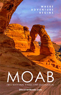
Moab Moab Moab
Southeast UtahMoab has long been a favorite destination for locals and world travelers alike. Southeast Utah is a must for any Utah traveler's itinerary.
Request this Free Visitor GuideRequested! You're all set! Request a few more Visitor Guides, or complete the form below to receive your guides by mail.
Capitol Reef Country Capitol Reef Country Capitol Reef Country
Central UtahThis area of southern Utah has a diversity of landscape like no other area in the state - red rock formations and canyons, pristine meadows, alpine forests, as well as lush green valleys. That landscape makes Capitol Reef Country perfect for outdoor activities such as hiking, biking, horseback riding, ATV tours, hunting, fishing, wildlife viewing, or just a quiet picnic!
Request this Free Visitor GuideRequested! You're all set! Request a few more Visitor Guides, or complete the form below to receive your guides by mail.
Ski Utah Ski Utah Ski Utah
Utah
Request this Free Visitor GuideRequested! You're all set! Request a few more Visitor Guides, or complete the form below to receive your guides by mail.